")
")
Expedition on board the RV “G.Yu. Vereshchagin” from 10 to 20 August 2021
The expedition along the southern, central and northern basins of Lake Baikal was carried out onboard the RV “G.Yu. Vereshchagin” from 10 to 20 August 2021. Additionally, fieldwork was carried out in Barguzin Bay. The expedition team included researchers from Laboratory of Ichthyology, Laboratory of Lake Baikal Geology and Laboratory of Interdisciplinary Environmental and Economic Research and Technologies of Limnological Institute SB RAS.
The aim of the expedition was to study the spatial distribution of zooplankton using mathematical modelling, modern methods of analysis and techniques of hydroacoustic sensing as a factor of the ecological condition of Lake Baikal.
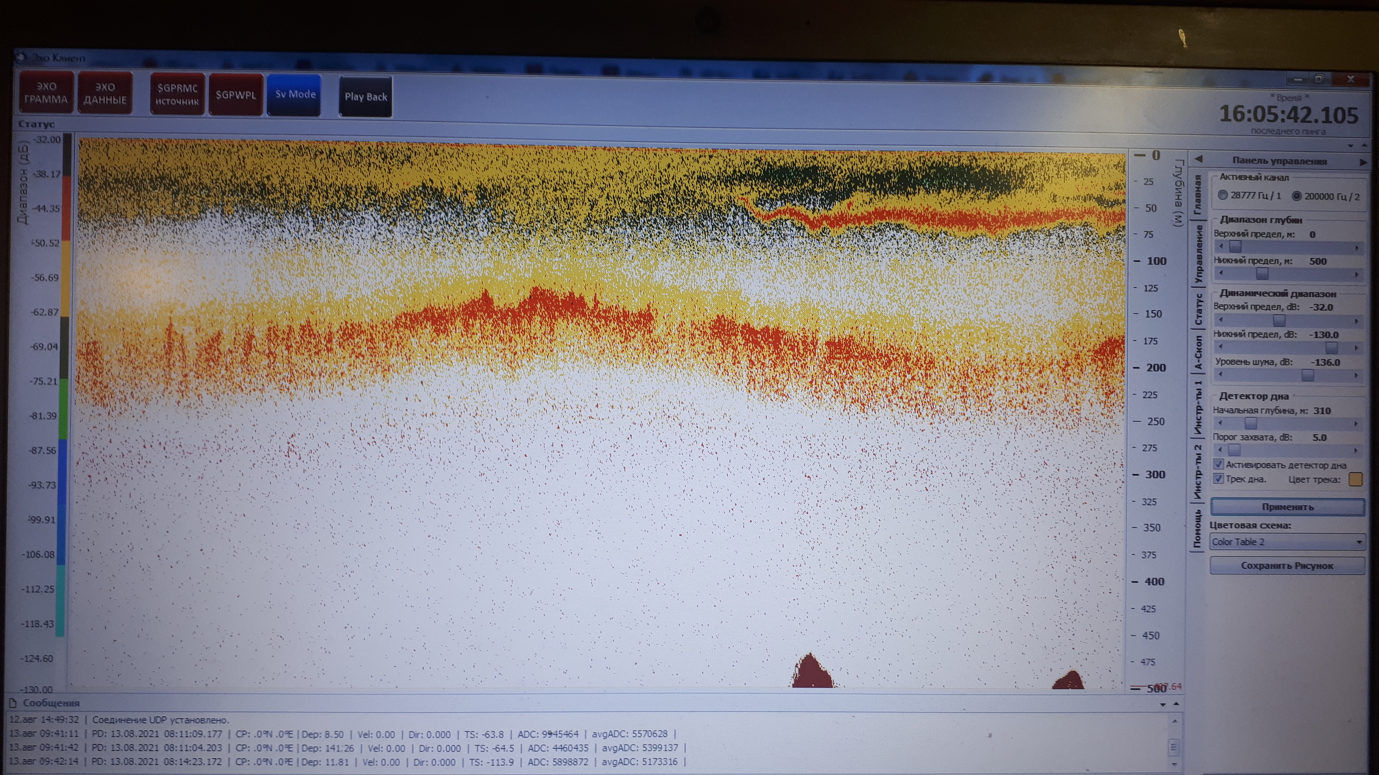
Zooplankton was sampled with plankton nets, Juday and JOM, along five longitudinal sections (three sites in each section) in three basins of Lake Baikal as well as at five sites of Barguzin Bay and four sites of the Maloye More Strait. At each site, zooplankton samples were taken in several water layers at different depths depending on the analysis of hydroacoustic survey data and data from a JFE Rinko AAQ-177 multiparameter water quality profiler. Overall, 76 zooplankton samples were taken. A primary visual assessment revealed an association between sound scattering layers observed with the echo sounder and the number of crustaceans in the samples. To control the depth of the lowering of the nets and fixation of the layer of their closure, an RBR Duo TD sensor was attached to them. The data from the sensor can increase the accuracy of estimating the volume of filtered water and the actual thickness of the water layer, from which the sample was taken. Ultimately, this significantly increases the accuracy of estimating the distribution of zooplankton.
Fieldwork in Barguzin Bay was carried out as part of the development of non-contact methods for assessing zooplankton reserves. For this purpose, night- and daytime acoustic surveys of a local area were carried out, and net catches were controlled in parallel. The obtained data will be processed, allowing the estimation of the equation coefficients for the relationship between the distribution density of zooplankton and the volume of acoustic scattering.
To study the issue of the distribution of environmental DNA in areas limited by the species range and beyond, sampes of water and soil were taken. Sampling was carried out at seven sites near Frolika Bay (northern basin of Lake Baikal), an area where the members of the endemic species of cottoid fish, Neocottus termalis, are locally concentrated. Two sites were located directly in the habitat zone of the species, and five sites were located at varying distances from the species range. Water was sampled at depths of 100, 200 and 30 m as well as at the bottom. Soil samples were also taken. The obtained material will indicate the reasonability of using environmental DNA in assessing the habitat boundaries of species and populations of Baikal hydrobionts.
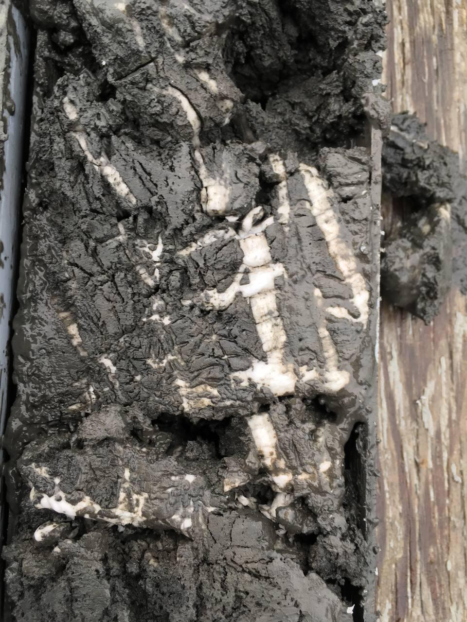
In the southern and northern basins of Lake Baikal, near the reference Malenky gas seep and Zelensip oil and gas seep, as well as the Kedr mud volcano, eight monitoring measurements of temperatures in the surface layer of bottom sediments were carried out. Similar measurements were carried out for these sites previously, and this will allow assessing the stability of gas hydrates in different seasons, taking into account changes in near-bottom temperature and water level of the lake. The measurements were carried out using a gravity corer with the attached temperature sensors, using which cores of bottom sediments up to 3 m long can be sampled. Additionally, samples of bottom sediments with oil were collected to study the composition of the oil.
RV “G.Yu.Vereshchagin” is equipped with a system for measuring the temperature and electrical conductance of surface water along the route of the vessel. Geographic coordinates supplement the data on the measured parameters and are saved on the PC. Analysis of the data obtained during the acoustic survey in Barguzin bay revealed that river water spreads along the peninsula as a thin strip, bends around the cape, and rushes to the northern basin of Lake Baikal. The data on the distribution of the surface temperature will be used to analyze the distribution of zooplankton.
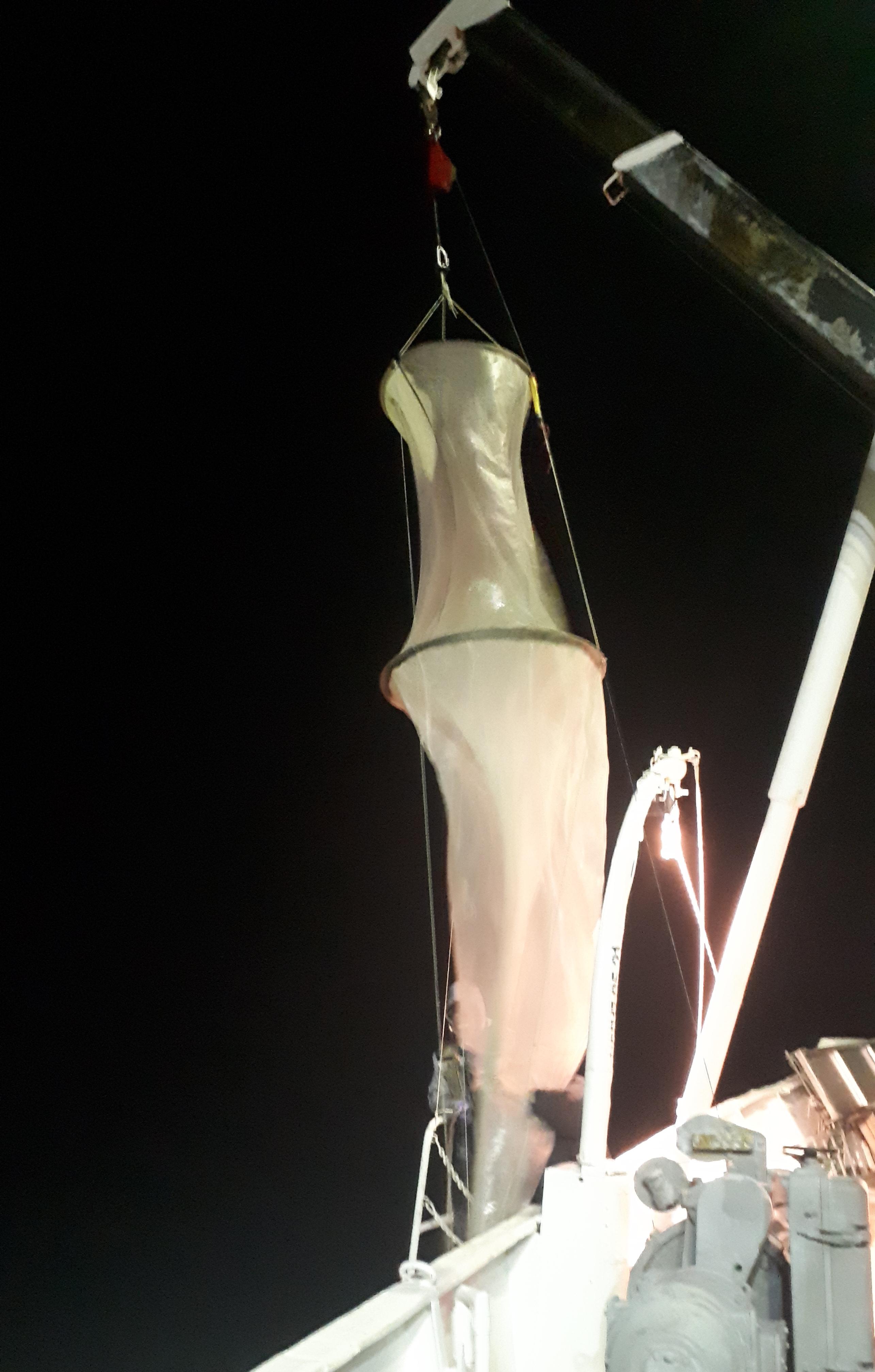
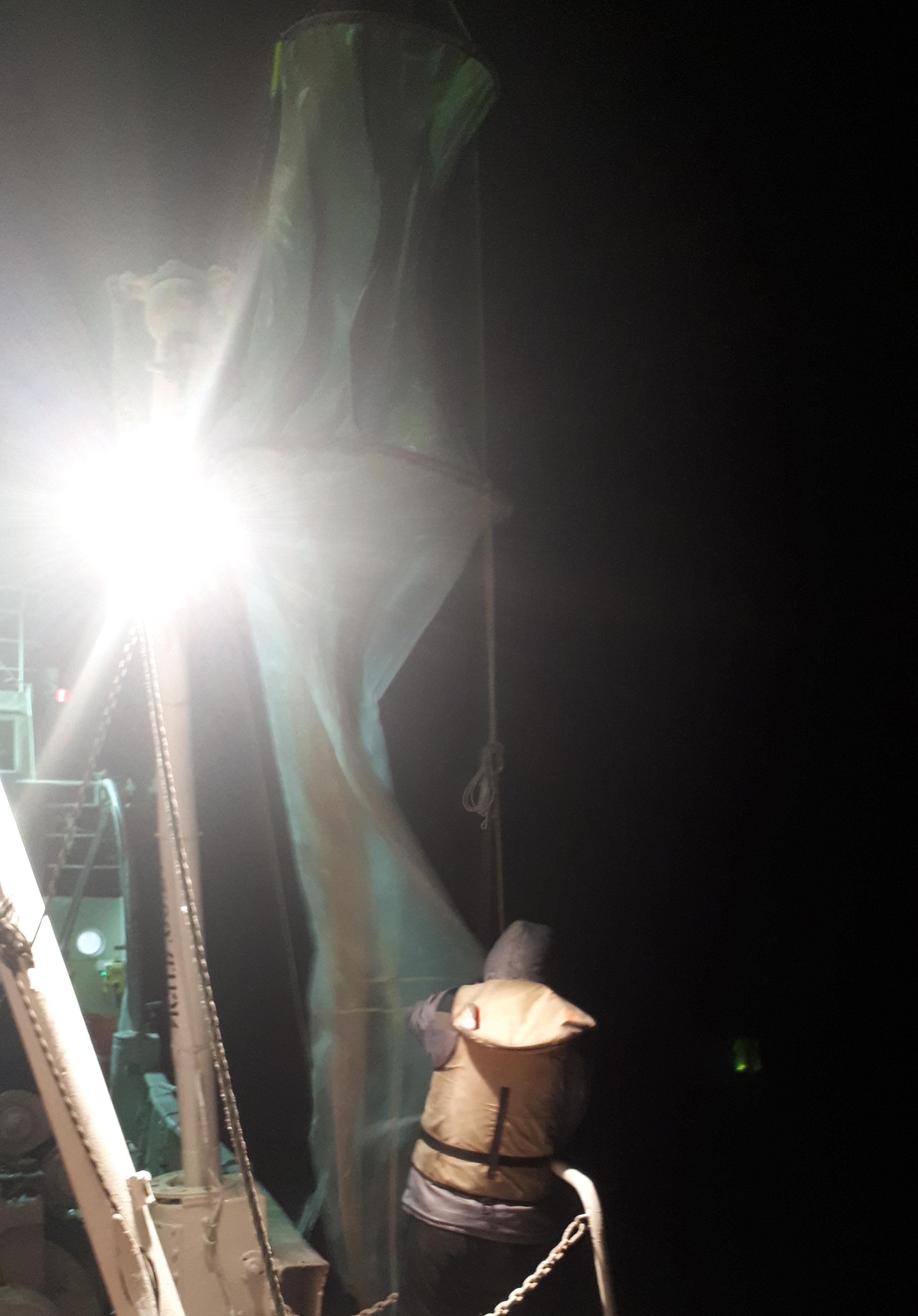
- Fieldwork with the JOM zooplankton net attached to the first winch on board the RV “G.Yu.Vereshchagin”.
- Fieldwork with the JOM zooplankton net attached to the first winch on board the RV “G.Yu.Vereshchagin”.
- Echogram depicting a sound scattering layer that is presumably zooplankton.
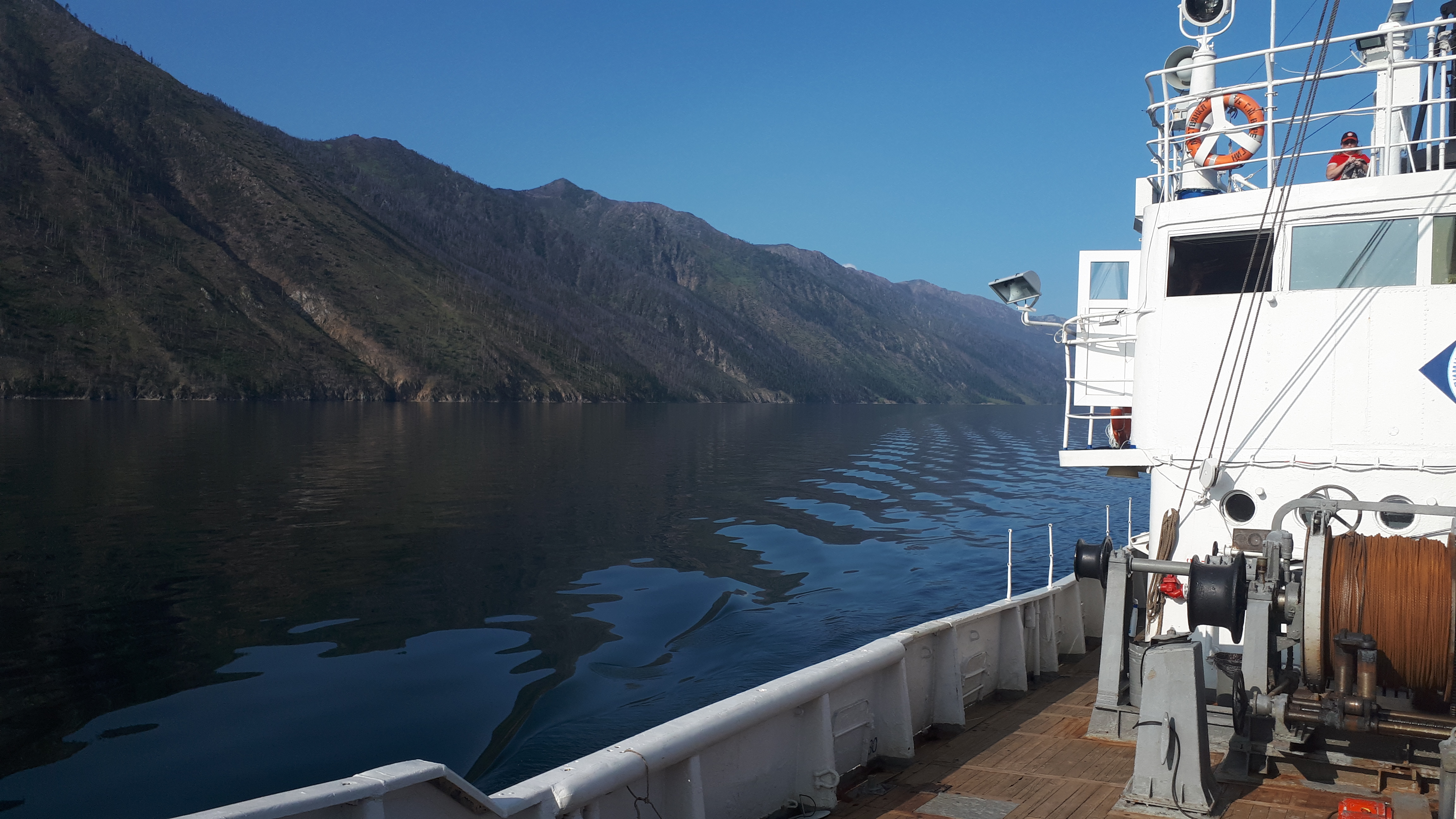
- Photograph of the southern tip of the Svyatoy Nos Peninsula, along which one of the tacks of acoustic zooplankton survey took place.
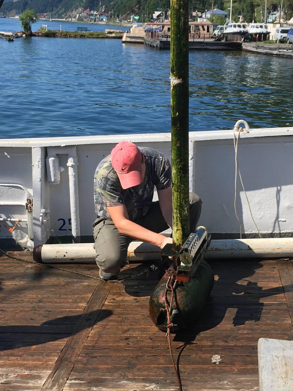
- Maintenance of hydroacoustic antenna and hydrophysical sensor.
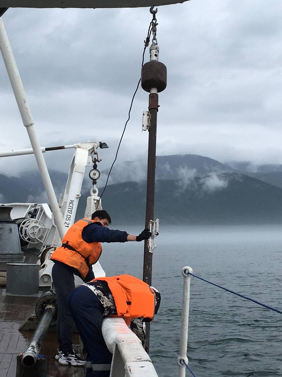
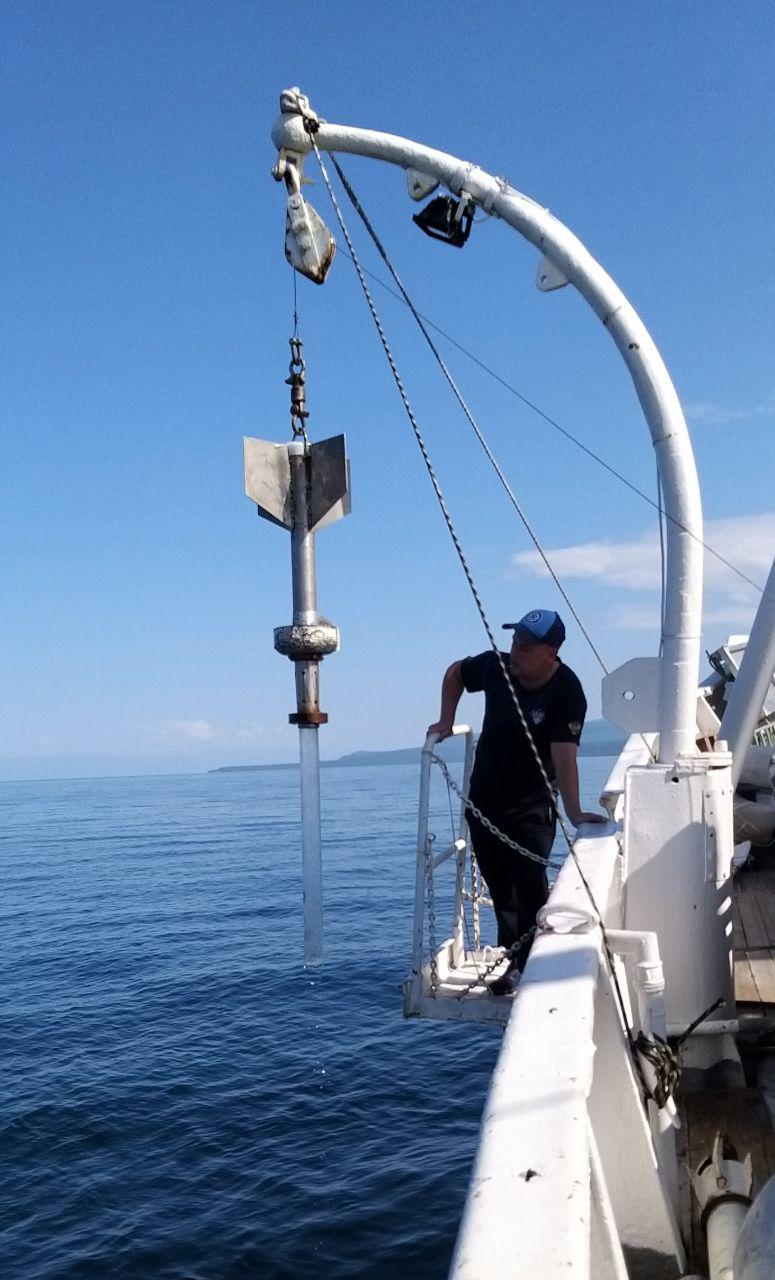
- Lifting of a gravity corer with autonomous temperature sensors (THP).
- Bottom sediments extracted from the gravity corer. White streaks are gas hydrates.
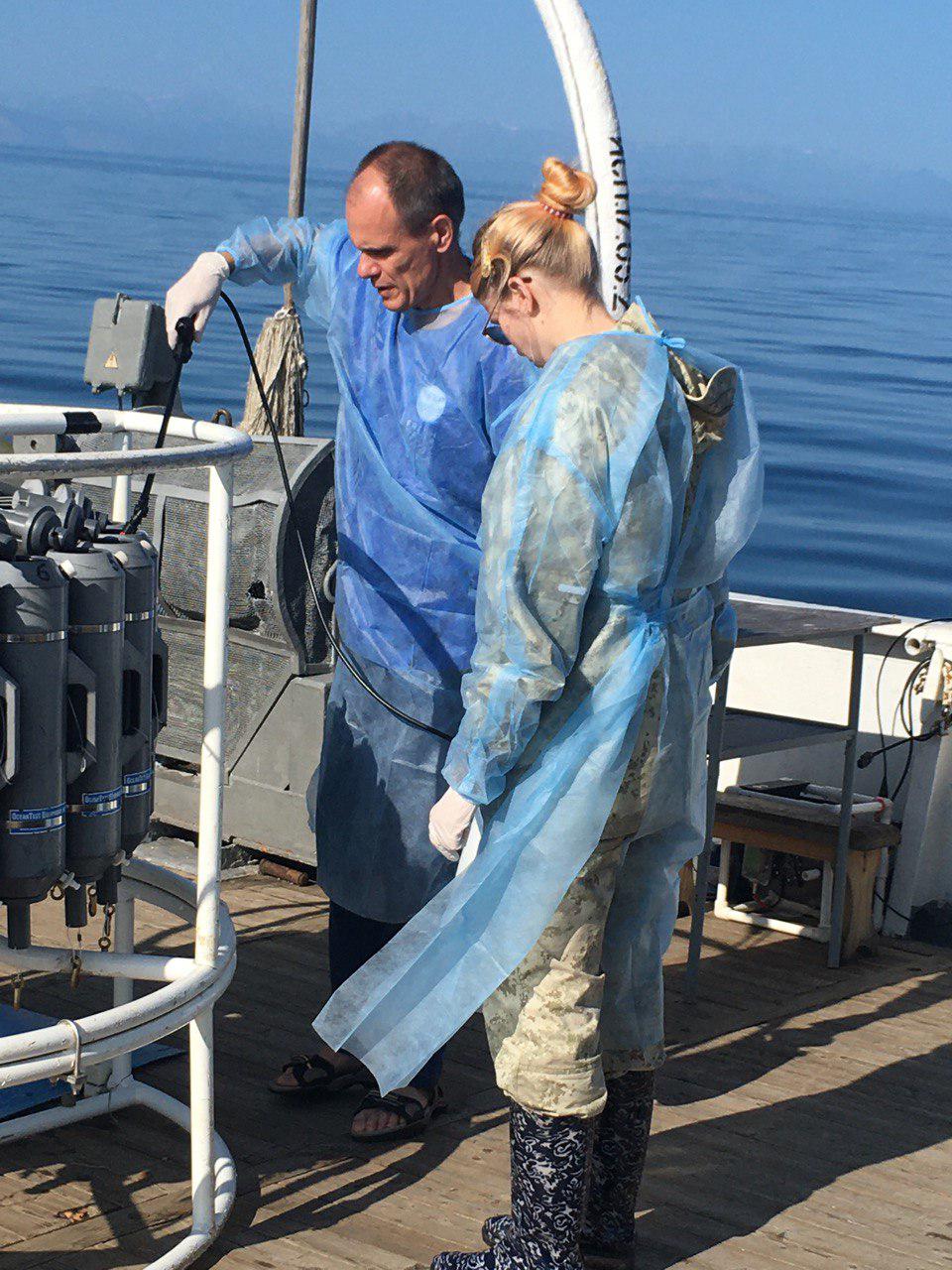
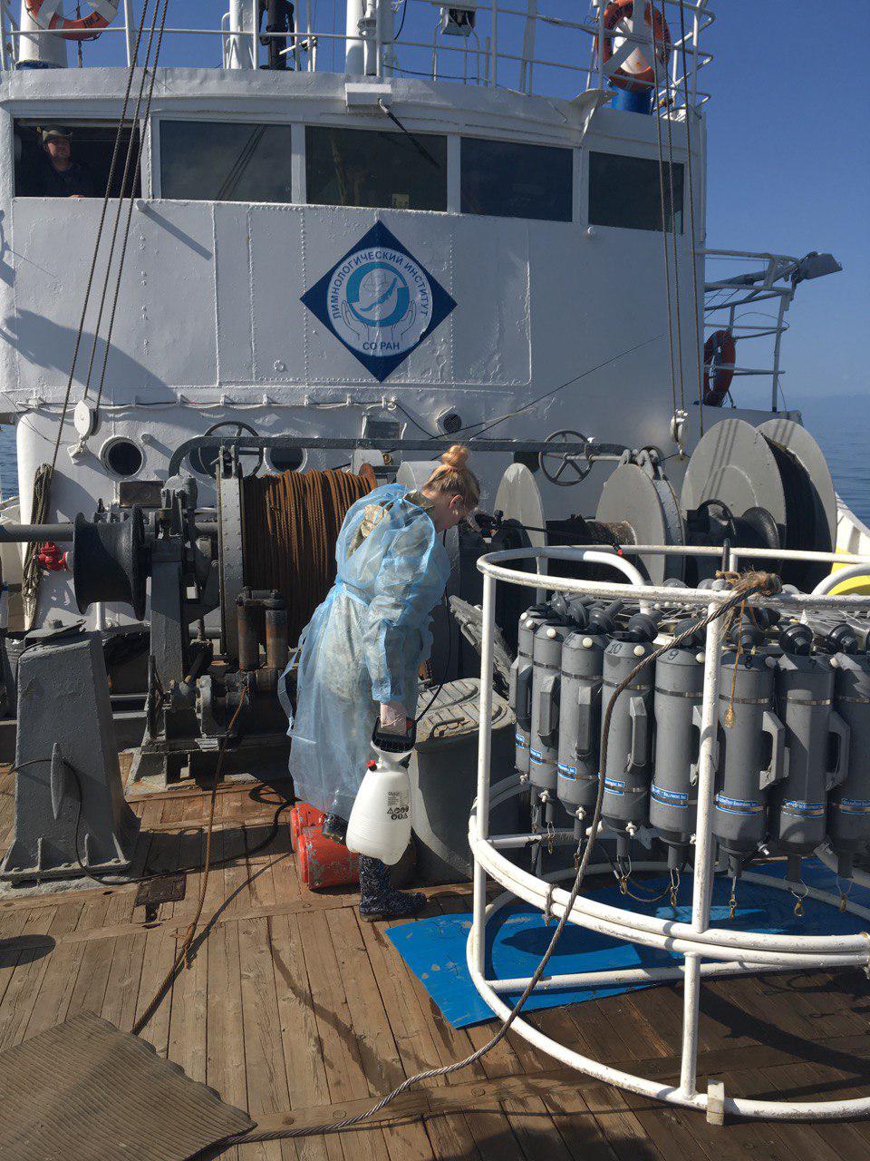
- Processing of rosette sampler before sampling for the extraction of environmental DNA.
- Processing of rosette sampler before sampling for the extraction of environmental DNA.
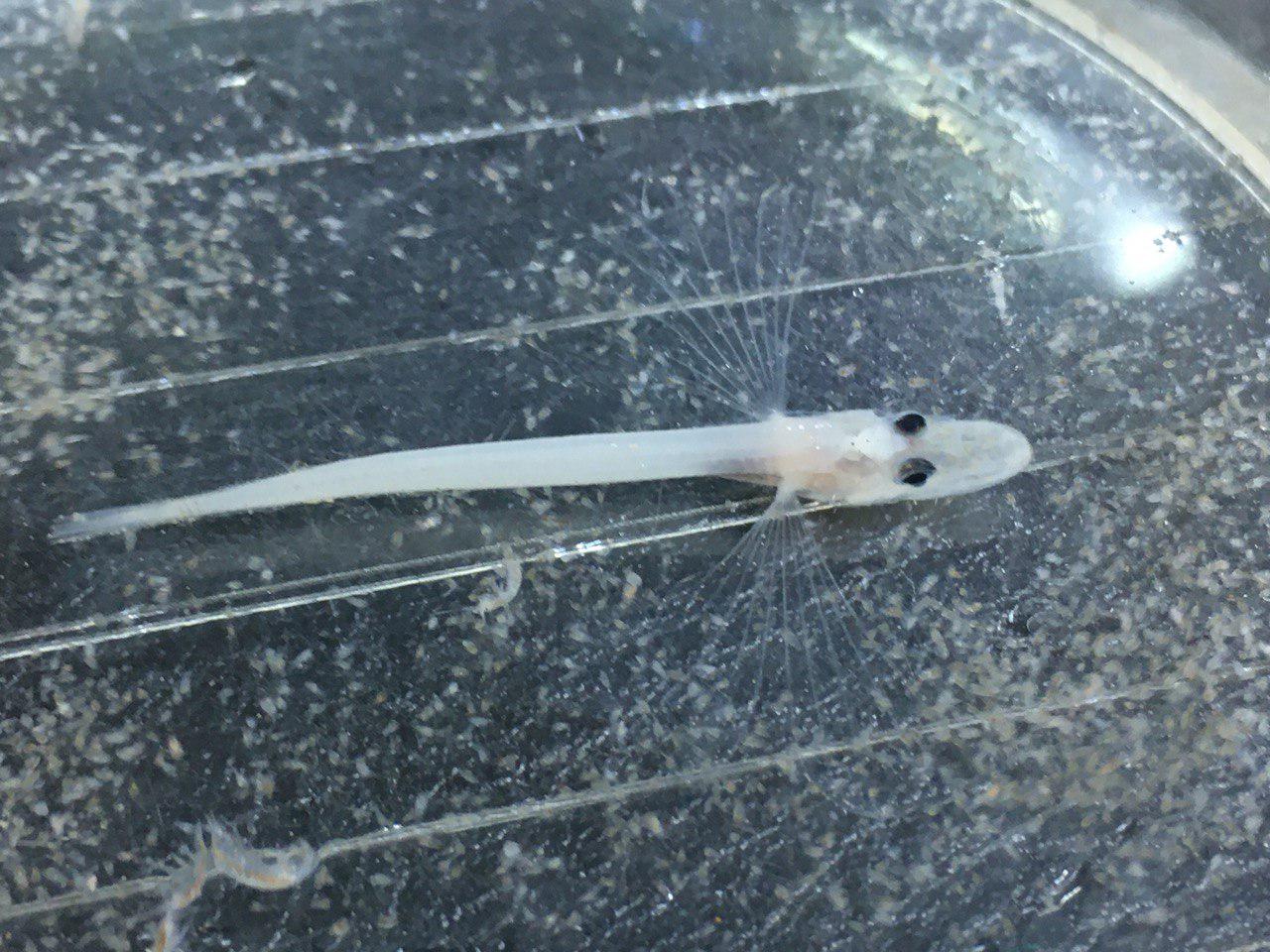
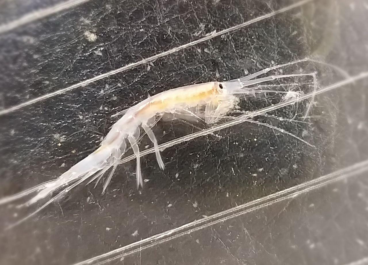
- Golomyanka and the large Macrohectopus amphipod caught with the Juday net.
- Golomyanka and the large Macrohectopus amphipod caught with the Juday net.
- Benthic corer prepared for sinking to the bottom.
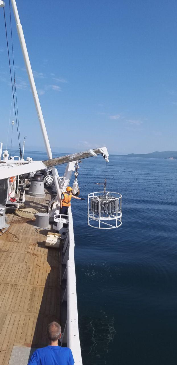
- Lifting of the rosette complex with water samples.
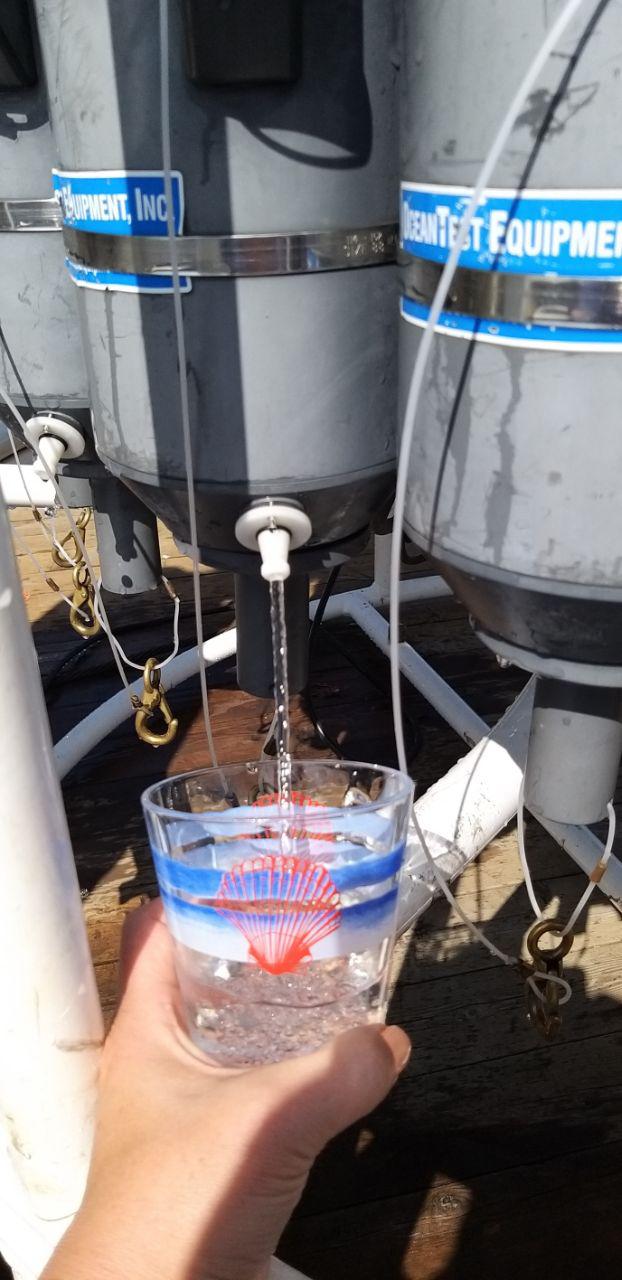
- Tasting of pure Baikal deep water